processed
PDF files1
Pages3
Objects24
Processing100%
main viewer
Selected page objects
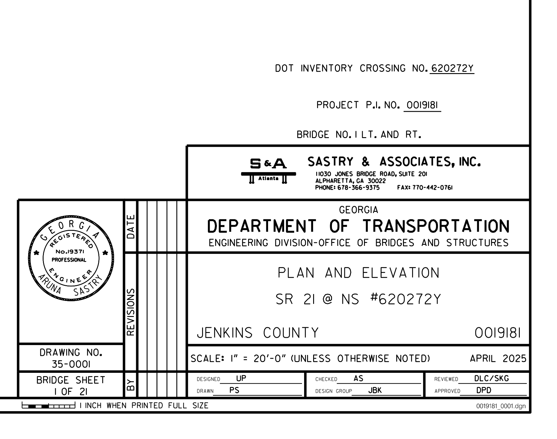 Title Block
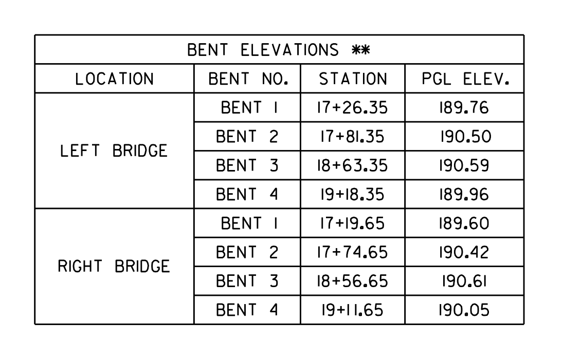 Bent Elevations
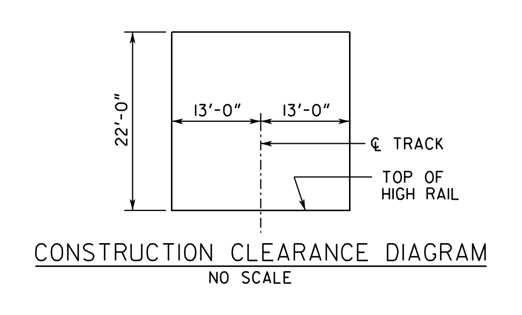 Construction Clearance Envelope Relative To Track
 Project Identification
 Vertical Curve Data Of Roadway Profile Grade Line
 Endfill Slope Control At Future Track
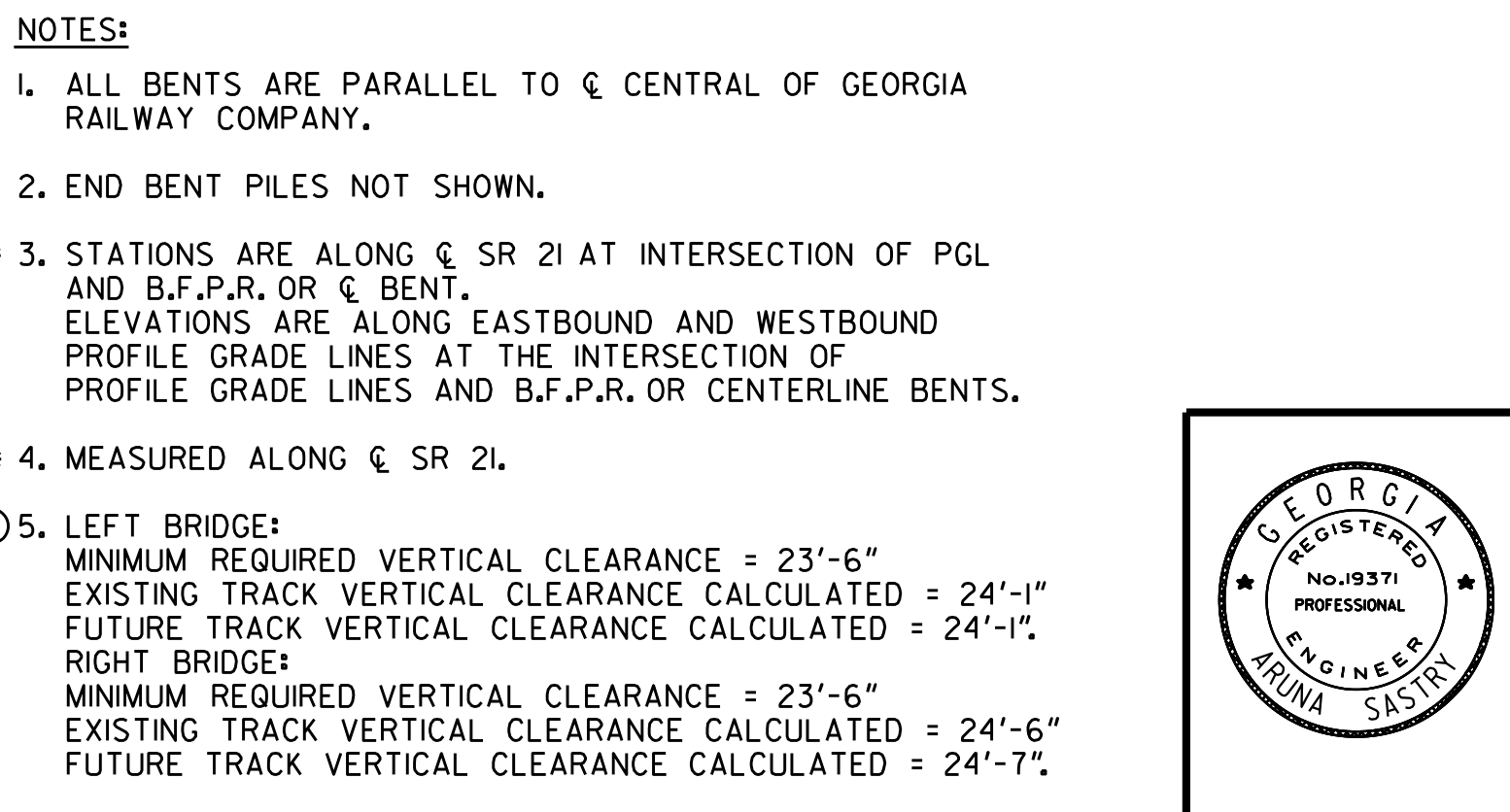 Bridge Notes
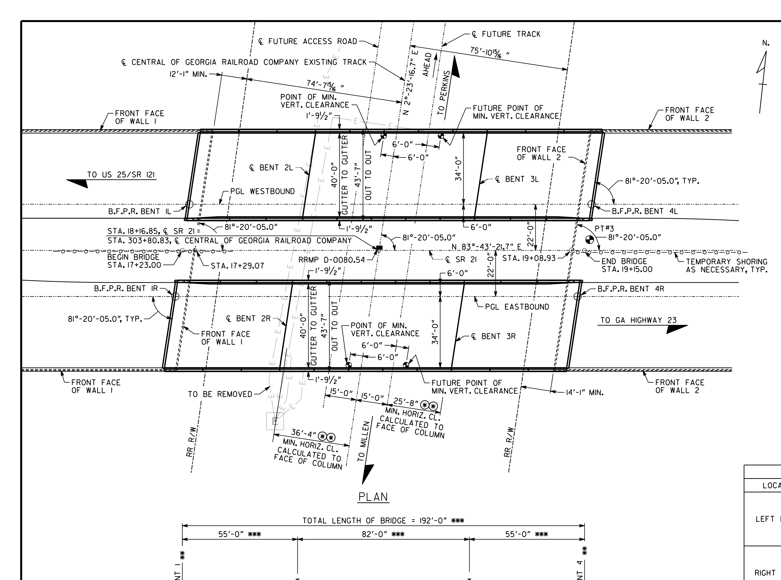 Bridge
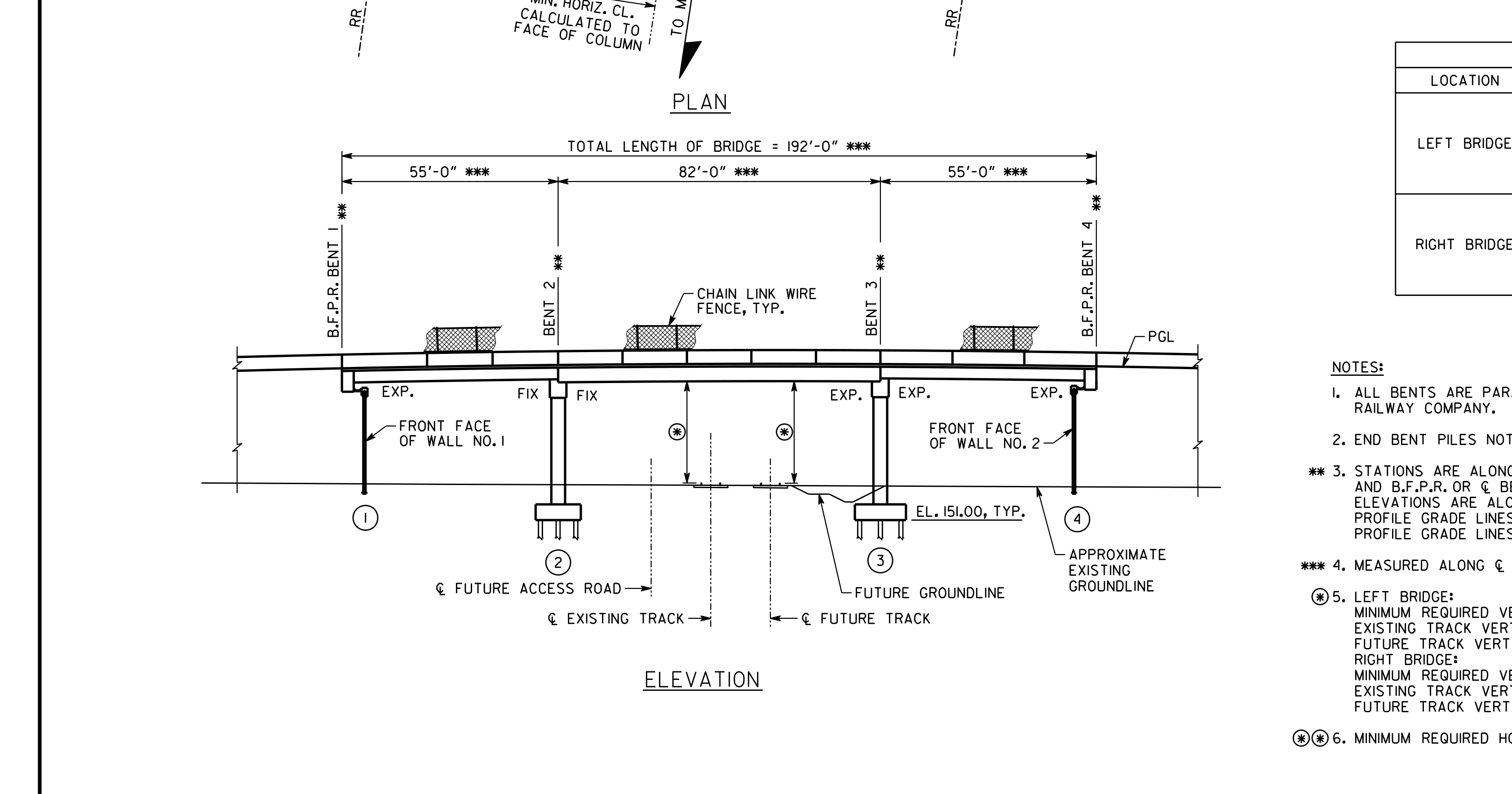 Bridge Over Railway
cropped image preview
CloseVertical Curve Data Of Roadway Profile Grade Line
- Object
- Vertical Curve Data Of Roadway Profile Grade Line
- Explanation
- vertical curve diagram showing PVI station, elevation, and grades for SR 21 westbound PGL
- View
- diagram
- Structure
- n/a
- Part of structure
- n/a
- Shows
- n/a
- Component
- vertical_curve_data_of_roadway_profile_grade_line
- Identifier
- n/a
- Section
- n/a
- Drawing no.
- n/a
- Scale
- n/a
- Discipline
- roadway
- Accuracy
- 90%+
- Tier
- max
- Page
- 354
- Bounding box
- 0.544, 0.069, 0.713, 0.434
- Remarks
- Recomposed from 2 adjacent regions detected as fragments of one drawing.
- QA comments
- review_required=True; mapping_relation=unresolved_singleton
- Linked tables
- BENT ELEVATIONS ** (same page)
- Cloudinary URL
- Open image
Raw extracted data
{
  "id": 4397,
  "type": "Earthworks",
  "view-angle": "none",
  "bbox": [
    0.5441882352941175,
    0.06865454545454545,
    0.7134588235294117,
    0.43404545454545457
  ],
  "confidence_score": 0.9,
  "remarks": "Recomposed from 2 adjacent regions detected as fragments of one drawing.",
  "qa-comments": "review_required=True; mapping_relation=unresolved_singleton",
  "column": "vertical_curve_data_of_roadway_profile_grade_line",
  "url": "https://res.cloudinary.com/laiuauox/image/upload/v1785704681/edapro/gdot_plan-d2e40218740d4c838fa740db83aa90ff/items/vertical_curve_data_of_roadway_profile_grade_line_p01_r03.png",
  "item_key": "vertical_curve_data_of_roadway_profile_grade_line_p01_r03",
  "label": "Vertical Curve Data Of Roadway Profile Grade Line",
  "caption": "vertical curve diagram showing PVI station, elevation, and grades for SR 21 westbound PGL",
  "view_type": "diagram",
  "section_label": null,
  "region_kind": "drawing",
  "drawing_number": null,
  "scale": null,
  "area": "ROB alignment",
  "identifiers": [
    "PVI STA. 18+10.00",
    "EL. 197.80",
    "+5.4180%",
    "-4.7671%",
    "560.0 FT. V.C.",
    "SR 21 PGL - WESTBOUND"
  ],
  "referenced_sheets": [],
  "uncertainty_codes": [],
  "tier": "max",
  "identifier": null,
  "discipline": "roadway",
  "view_types": [
    "diagram"
  ],
  "linked_notes": "NOTES (same page)",
  "linked_tables": "BENT ELEVATIONS ** (same page)",
  "shape_summary": {
    "line_run": 2,
    "polygon": 2,
    "total": 4
  },
  "merged_from": [
    "vertical_curve_data_of_roadway_profile_grade_line_p01_r03",
    "roadway_profile_grade_line_vertical_curve_p01_r05"
  ],
  "page_id": 354,
  "file_id": 65,
  "project_id": "6a6fabd1912a5c0ee11a8ab1",
  "token_count": 729219
}